


Project Description
Client: Signal Hill Petroleum Company
Location: Signal Hill, California
Project: Fault Investigations
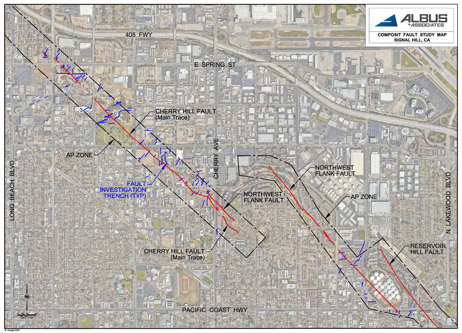
Signal Hill has a long history of oil production, and a longer history of bedrock faulting. This firm has been investigating fault locations since 1999, when we were the Geotechnical firm of record during development of the hilltop from oil fields to residential homes by Comstock, Crosser & Associates. In the years since we have investigated numerous properties for the Signal Hill Petroleum Company and for private owners of properties wanting to develop their properties. Fault studies provided the property owners the locations of active and inactive fault locations, or the absence of faults, on their properties so that they could design their site development with safe buffer zones between the faults and proposed habitable structures. After years of fault investigations by us and various other geotechnical firms, we developed the composite Fault Location Map presented below for the Signal Hill Petroleum Company, a major owner of properties in Signal Hill, so that their planning team can anticipate the limitations that active faults may present on their properties not yet developed.
The Challenges
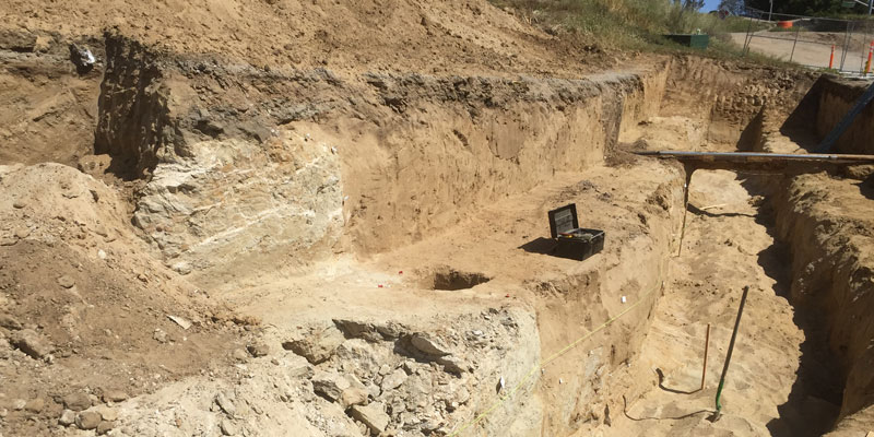
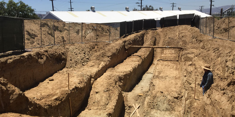
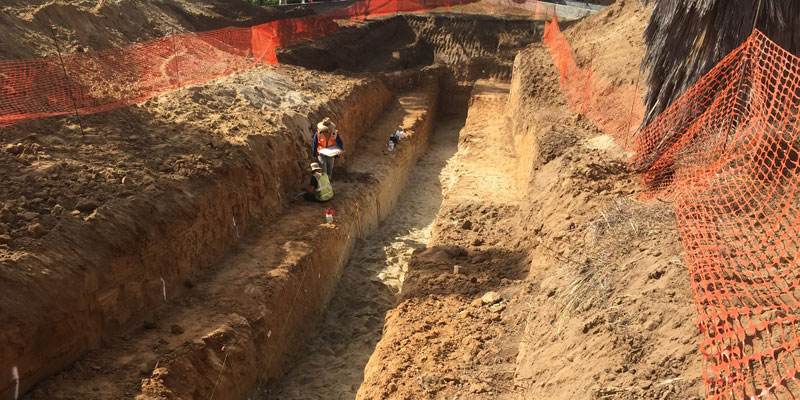
A typical fault trench investigation involved the excavation of trenches semi-perpendicular across the anticipated location and trend of a fault. These trenched were excavated with excavators to depths of 20 feet or more, with the sides laid back and benched to provide safe access for our geologists. The trench sidewalls were cleaned off to expose the geologic formations and characteristics that showed the history of ancient and near geologically recent activity.
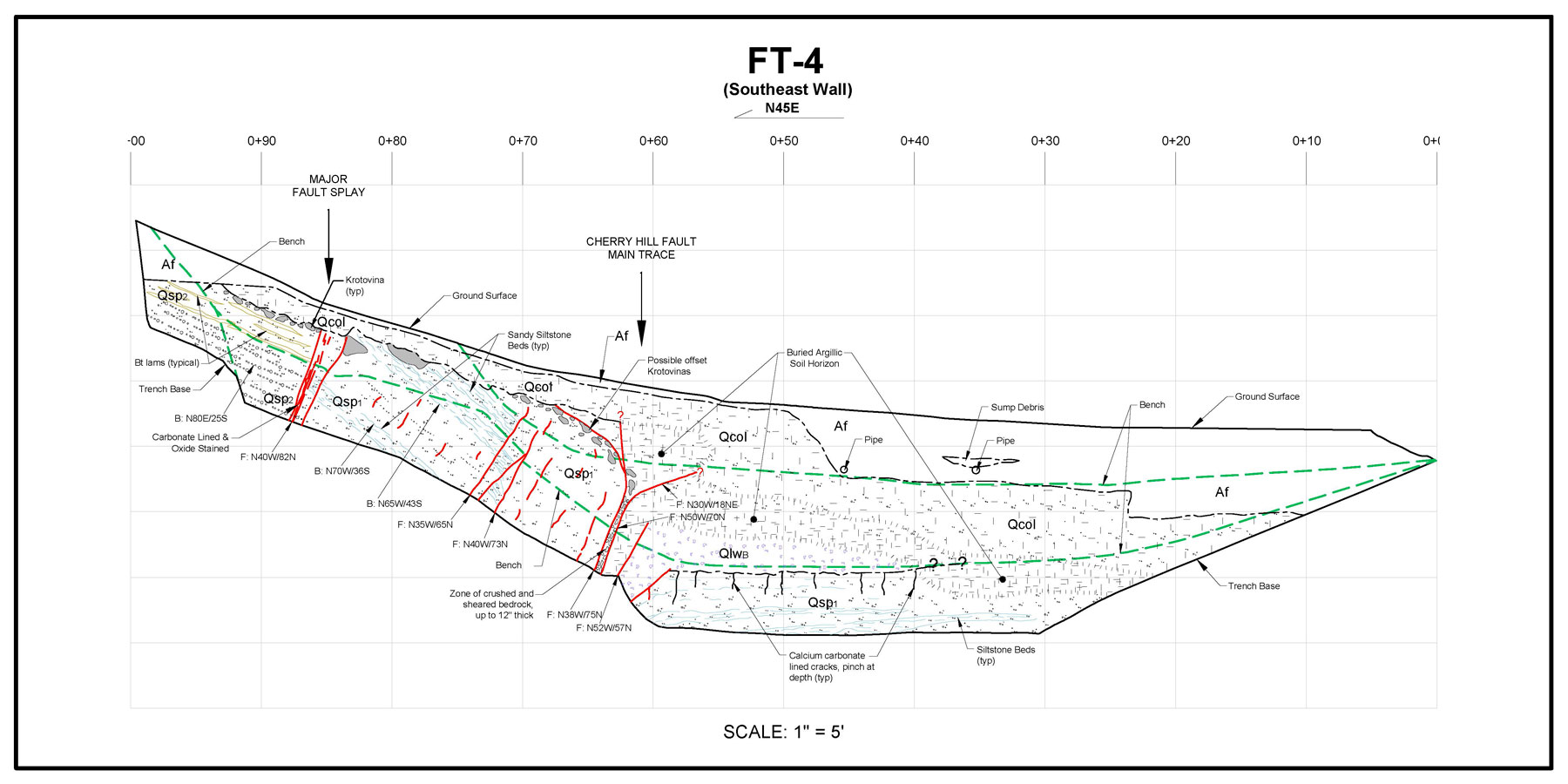
Our geologists painstakingly mapped, with pencil on graph paper, at least one sidewall of the trench, concentrating on areas showing faulting and fracturing, and on areas near surface which might give clues to how recent of how far in the past the faulting and fracturing occurred. The field trench logs were then illustrated using AutoCad to produce the graphic trench logs like the one shown here.
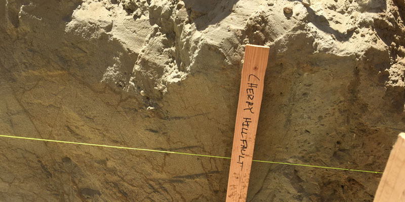
As shown on the FT-4 trench log above, main fault traces can be identified by having different bedrock units on either side of a fracture, such as San Pedro Formation of the left side and Lakewood Formation on the right side of the Cherry Hill Fault Main Trace. Other identifying evidence could be the offset of sand and gravel beds, offset of near surface features such as krotovinas (infilled rodent burrows). The development of argillic soil horizons, which in a simple definition is the weathering of bedrock into soil, can give an indication of how long ago a fracture occurred. Our firm has employed experts in determining the age of argillic soil to visit the site and determine if a fault can be considered inactive or not. This can be a very important determination. A fault considered active required a structural setback restricting the construction of habitable structures, where a fault considered inactive would not require any restrictions.
When mapping and assessment has been completed, the trenches are backfilled using the materials excavated from the trenches, The backfill is placed in moisture-conditioned and compacted lifts of about 8- to 12-inches in thickness. A soil technician from our firm observes the backfill operations and performs field density tests to demonstrate that the backfill in properly compacted.